Entered into the database on Friday, September 02nd, 2005 @ 13:29:06 MST
Ivan and Katrina These are both very Russian sounding names. It has been established
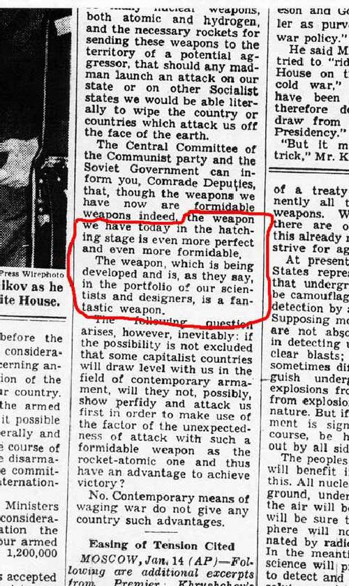
that the former Soviet Union (fSU) developed and boasted of weather modification
technology during the 1960's and 70's with deployment against the United States
coming in 1976 with the audible arrival of the woodpecker grid. These weather
operations continue to this day. I have posted this page FAR sooner than I would like to have. I would like
to have had the post mortem of Katrina from the National Hurricane Center to
work from as well as a little time/distance from the events of this week so
that perspective can be maintained. I will continue to update and add to this
page in the days ahead. This nation has not faced an economic crisis like the one that Katrina will
spark in the days and months ahead. But that is one of the reasons Katrina was
guided along the path that we all watched. This path has resulted in maximum
damage to the energy infrastructure, transportation infrastructure and to the
psyche of those that are susceptible to further storms this year and in the
years to follow. Oh New Orleans! I fully expect one more 'event' this year to impact the United States. My gut
feeling is that it will be an earthquake >7.7 in magnitude with insured losses
to exceed $25 billion. That number should have been less but presently real
estate is far overvalued. Protect your family's wealth with precious metals as the cascading effects
from this disaster and from poor government fiscal management, will have just
begun to be felt. My prayers go out to all who need a helping hand in the very difficult times
ahead. The amount of social change that this storm has begun to unleash upon
the fabric of American society has not yet been grasped by the media, but then
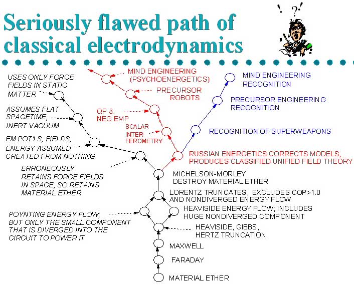
what's new! “Maxwell's” vector equations taught in university are actually
Heaviside's truncated equations, and are only a simplified version of what Maxwell
originally wrote. The Maxwell-Heaviside theory of electrodynamics is now well over a century old,
and is actually a serious truncation of Maxwell's 1865 theory of 20 equations
in 20 unknowns (those are specifically listed in the original published paper
in 1865). Because it was “ tainted ” with a higher group symmetry
algebra (quaternions), even Maxwell himself came under intense pressure to simplify
it, after the publication of the first edition of his famous Treatise in 1873.
Consequently, Maxwell was rewriting and greatly “ watering down ”
his own Treatise, having finished rewriting and greatly reducing some 80% of it
at the time of his death in 1879. The second edition and third edition, therefore,
are NOT the original Maxwellian theory, but a very serious truncation. This weapons platform has been operational since 1963! The woodpecker grid (Google woodpecker grid) which has weather modification
capabilities was turned on July 4th 1976. http://news.yahoo.com/s/ap/bush_katrina "It's worse than imaginable," the president said after walking
through a battered neighborhood in Biloxi, Miss. He warned of gasoline supply
problems this weekend because of damaged refineries and pipelines. "I'm not looking forward to this trip," Bush said as he toured
Alabama and Mississippi and headed for Louisiana. "It's as if the entire
Gulf Coast were obliterated by the worst kind of weapon you can imagine,"
he said. I whole heartadly agree with the President on this fact!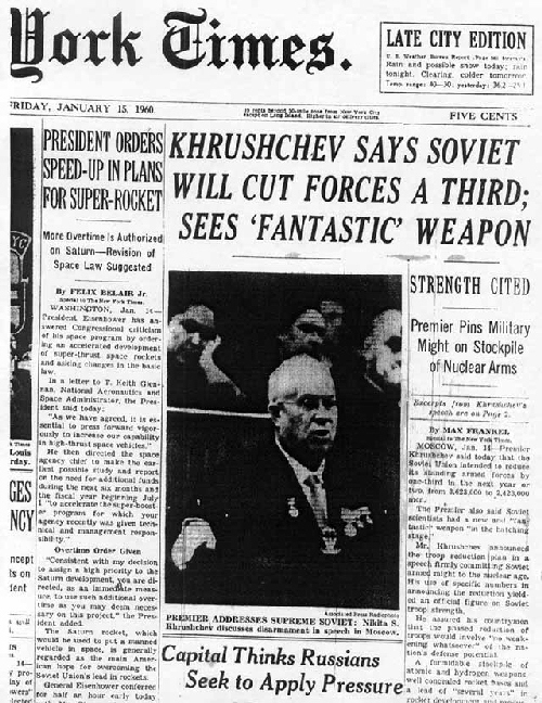
http://www.cheniere.org/references/maxwell.htm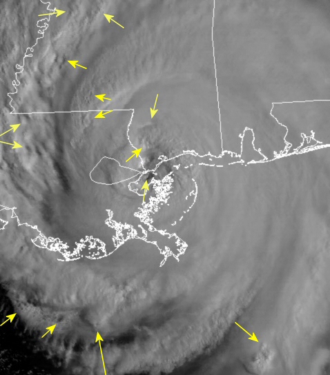
29 August 2005 1425Z Katrina makes landfall Monday morning. Many scalar
signatures visible as the hurricane rolls over the marshy lowlands of southeastern
Louisiana.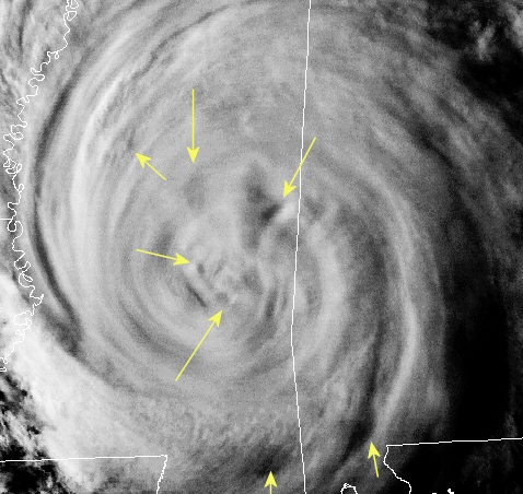
August 29, 2005 2225Z 6:25pm Eastern Katrina is now well inland but
still a category one hurricane. Scalar geometry litters the core of this massive
tropical storm.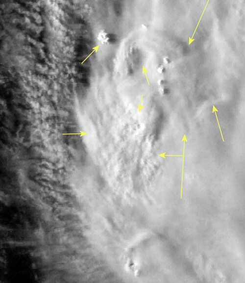
August 28 2005 2310Z Katrina still south of the Mississippi the evening
before landfall. 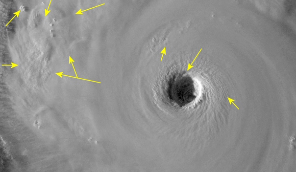
28 August 2005 2310Z A beautiful satellite presentation of the eye while
below winds roar at 155mph!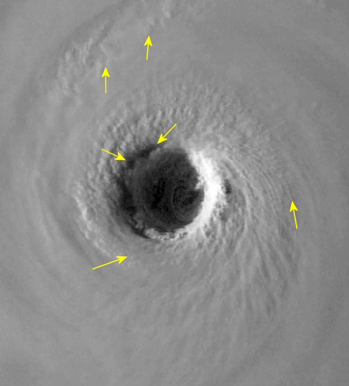
29 August 2005 2310Z A closer view and just five minutes later than the previous image.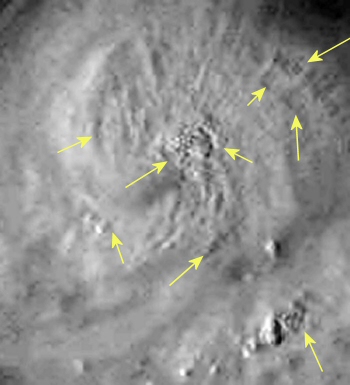
26 August 2005 2115Z Off of the West coast of Florida while Katrina undergoes rapid intensification. Many, many odd holes bounded by squares.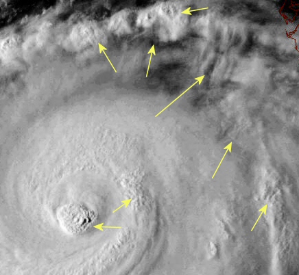
27 August 2005 2203Z Intensification continues in the Gulf Saturday afternoon.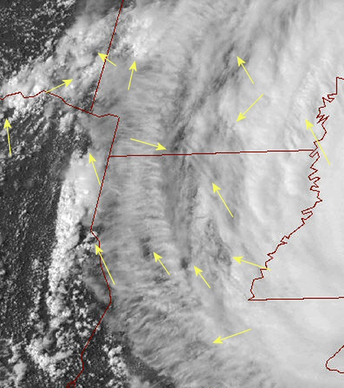
29 August 2005 2032Z Late Monday afternoon as Katrina continues her push inland. This is the western portion of the storm displaying many holes used as anchoring points for thunderstorm development.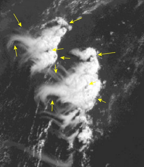
30 August 2005 1445Z One of the feeder bands on the eastern side of Katrina. What caught my attention was the odd shape of the thunderstorms, but also just how similar in shape the two clusters of storms are. 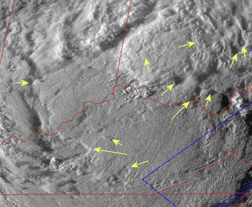
30 August 2005 2315Z 715pm Eastern A very low sun angle on the remnants of Katrina Tuesday evening reveal the intricate detail to be seen in the clouds that are made visible by the play of shadows across the cloud tops. Note the large diagonal square across southern Indiana with the top of the square being toward the top center frame.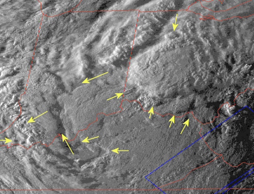
30 August 2005 2330Z Note the diamond/square impression with a large and similarly shaped grouping of storms toward the north and east across southwestern Ohio.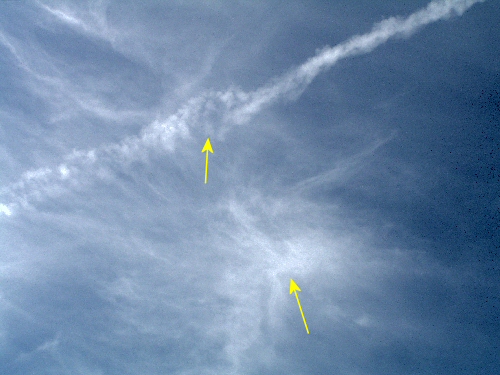
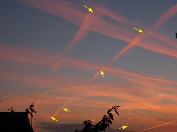
Contrail operations have largely ceased throughout the Western US as the planes have been needed with Katrina and other tropical storms this season. As activity in the tropics winds down expect these aircraft to return to their normal zones of operation.